
Remote Sensing & Satellite Technology
A network of government satellite programmes — YES-TECH, WINDS, FASAL, NADAMS, Bhuvan and Krishi-DSS — now feeds directly into how fast a PMFBY crop-insurance claim is settled and whether a district gets a drought declaration, at zero cost to the farmer and with nothing to buy or apply for.
- Min. 30% Weightage (YES-TECH)
- 11 Crops / 20 States (FASAL)
- ₹0 Cost to Farmer
- Free Public Access (Bhuvan)
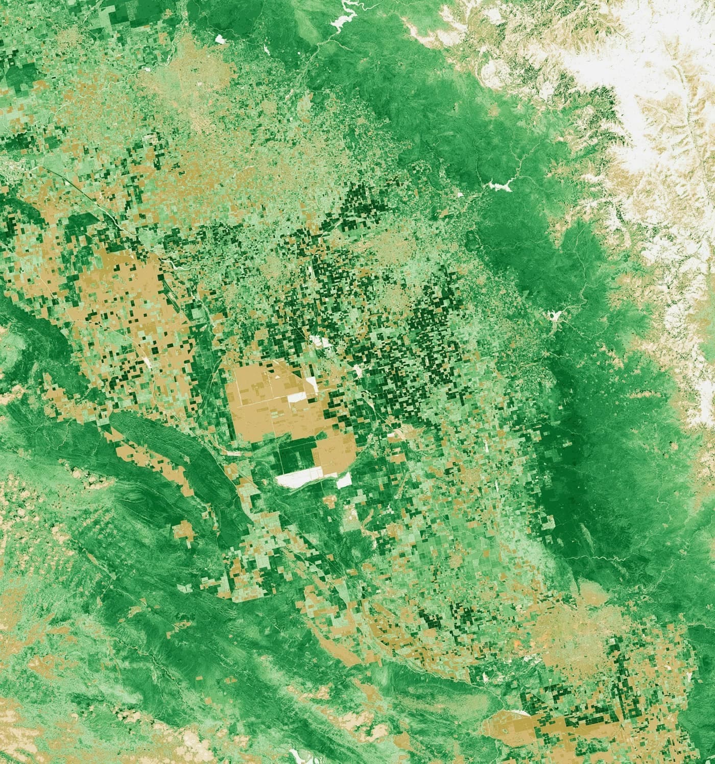
Every other technology on this hub is something a farmer buys, installs or switches on. This one is not. Remote sensing and satellite technology in Indian agriculture is a set of national programmes — run by the Ministry of Agriculture, ISRO's National Remote Sensing Centre and the Mahalanobis National Crop Forecast Centre (MNCFC) — that read a satellite image of a field instead of sending a person to it, and feed that reading into decisions that already affect a farmer: how a PMFBY crop-insurance claim gets calculated, whether a district is declared drought-affected, and increasingly, how a bank assesses an agricultural loan.
This page exists because this hub's own editorial rule is not to fill a card with invented content — for a long time, this was the one category here marked "coming soon" for exactly that reason. What changed is that the technology is real, documented and already running at national scale, even though it looks nothing like the other pages on this hub: there is no product to compare, no price to budget, and no installation step. What follows is what these programmes actually do, which of them apply to which crop and state today, and — just as honestly — where they do not reach yet.
Remote sensing & satellite technology at a glance
The numbers that matter, since there is no price tag to check here.
- Technology Weightage
- Minimum 30% mandated in PMFBY yield estimation (YES-TECH)
- FASAL Coverage
- 11 major crops across 20 states / 557 districts
- Cost to Farmer
- ₹0 — fully government-funded, nothing to buy or apply for
- Free Public Tool
- ISRO's Bhuvan geoportal — live since 2009
- Drought Monitoring
- NADAMS: fortnightly reports across 14 states, running since 1990
- YES-TECH States
- 9 states adopted so far; Madhya Pradesh fully technology-based
How satellite technology actually reaches a farmer
Three layers: satellites overhead, government analytics centres, and the decisions that follow.
Three layers sit between a satellite passing overhead and anything actually changing for a farmer. First, Earth-observation satellites — ISRO's own Resourcesat and Cartosat series among others — capture multispectral and microwave (radar) imagery of the entire country on a repeating cycle, dense enough to read vegetation health, soil moisture and crop extent field by field. Second, government analytics centres — mainly the Mahalanobis National Crop Forecast Centre (MNCFC) and ISRO's National Remote Sensing Centre (NRSC) — turn that raw imagery into usable numbers: a vegetation-health index (NDVI), a yield estimate, a drought-severity rating, compared against weather data and years of historical records for the same fields.
Third, and this is the step that actually reaches a farmer, that output feeds into a decision that was already being made some other way. A PMFBY crop-insurance payout, that used to rest entirely on a manually harvested sample plot, now includes a technology-based yield estimate where YES-TECH applies. A drought declaration, that used to rely on rainfall gauges and field reports, now draws on NADAMS's satellite reading too. See the programmes below for what each layer of this actually does, and what you can actually do for the two steps in this whole chain a farmer can act on directly.
The six programmes behind the technology
What each one actually is, run by whom, and what it is for.
YES-TECH (PMFBY)
Yield Estimation System based on Technology — an MNCFC-run system inside PMFBY that assigns a minimum 30% weightage to a satellite-and-AI-derived yield estimate in the insurance payout calculation, reducing reliance on manual Crop Cutting Experiments alone. Started with paddy and wheat in Kharif 2023, extended to soybean in Kharif 2024; adopted by 9 states so far, with Madhya Pradesh fully technology-based.
WINDS
Weather Information Network & Data System — a hyperlocal automatic weather station (AWS) network launched in July 2023, funded through PMFBY's own technology fund. It feeds the dense, local weather data that YES-TECH's yield models need, aimed at faster, more defensible PMFBY claim settlement.
FASAL
Forecasting Agricultural output using Space, Agro-meteorology and Land-based observations — MNCFC's satellite-based pre-harvest production forecasts for 11 major crops, across 20 states and 557 districts, combining multispectral and microwave satellite data with weather-based yield models.
NADAMS
National Agricultural Drought Assessment & Monitoring System — ISRO's NRSC has run this since 1990, producing fortnightly satellite-based drought severity assessments at state, district and sub-district level across 14 drought-prone states, used as input to official drought-declaration decisions.
Bhuvan
ISRO's free public geoportal, live since August 2009 — the one part of this entire system anyone can open and browse directly, with no login, fee or insurer in between. Satellite imagery, NDVI vegetation-health layers and agricultural-drought maps, available in English, Hindi, Tamil and Telugu.
Krishi-DSS
The Digital Agriculture Mission's Decision Support System, launched August 2024, unifying satellite, soil and weather data into one AI-powered layer, with a target of mapping 142 million hectares of soil profile nationally. Still rolling out state by state through 2026 — not yet a finished, everywhere-available tool.
Which crops FASAL forecasts by satellite
Eleven major crops, pre-harvest, across 20 states and 557 districts.
Paddy (Rice)
One of the first two crops covered when YES-TECH launched in Kharif 2023.
Wheat
Covered alongside paddy since YES-TECH's Kharif 2023 launch, now also a rabi FASAL forecast crop.
Soybean
Added to YES-TECH in Kharif 2024, the technology's first expansion beyond its original two crops.
Cotton
A FASAL pre-harvest forecast crop, not yet part of YES-TECH's insurance-claim coverage.
Sugarcane
Forecast under FASAL for production planning, separate from any insurance-claim use.
Arhar (Tur)
One of FASAL's tracked pulses, forecast pre-harvest across its covered states.
Gram (Chana)
A rabi pulse in FASAL's 11-crop coverage list.
Mustard
A rabi oilseed FASAL forecasts alongside wheat and gram in the same season.
Jute
The one fibre crop in FASAL's coverage list, alongside nine food-grain and oilseed crops.
Jowar (incl. rabi sorghum)
FASAL separately forecasts rabi sorghum from the kharif jowar crop covered on this site.
What you can actually do with this today
Six steps — most of this runs automatically; two of them are things you can genuinely do yourself.
1. Understand that most of this happens for you automatically
If you are enrolled in PMFBY, in a state and for a crop where YES-TECH applies this season, the technology-based yield estimate already feeds into your claim calculation. There is no separate form to fill, app to download or setting to turn on.
2. Check whether your state and crop are actually covered
YES-TECH currently covers paddy, wheat and soybean in 9 states (as of the latest verified rollout: Andhra Pradesh, Assam, Haryana, Uttar Pradesh, Madhya Pradesh, Maharashtra, Odisha, Tamil Nadu and Karnataka). Ask your bank, Common Service Centre, or the PMFBY helpline whether your specific crop and district are included this season — the list has expanded most years since 2023.
Coverage is crop- and state-specific, not universal — most crop-state combinations in India are still assessed the traditional way.
3. Browse Bhuvan yourself, for free
ISRO's public geoportal (bhuvan.nrsc.gov.in) lets anyone view satellite imagery, NDVI vegetation-health data and drought maps for any location in India — no login, fee or insurer needed. It is a technical, GIS-style tool rather than a farmer app with alerts, but it is genuinely open to the public in English, Hindi, Tamil and Telugu.
4. Watch for Krishi-DSS through your state agriculture department
The Digital Agriculture Mission's satellite-linked advisory layer is still rolling out state by state through 2026. Ask your local Krishi Vigyan Kendra or district agriculture office whether it has reached your area yet, rather than assuming it is already live everywhere.
5. Know that a drought declaration still follows an official process
NADAMS informs the government's drought assessment, but the state or district administration still makes and announces the formal declaration through its own review process. A satellite reading showing stress is an input to that process, not a relief payment by itself.
6. Expect satellite data in loan and insurance underwriting too
Banks and insurers increasingly use private analytics platforms alongside government data to assess land and crop condition for agricultural loans — a shift worth knowing about even though it is not something a farmer initiates directly.
Manual Crop Cutting Experiments vs technology-based estimation
What actually changes when YES-TECH applies to your crop and state.
YES-TECH does not replace manual Crop Cutting Experiments outright — it blends technology-based estimation in, at a mandated minimum weightage, alongside them. This table sets out what actually changes where it applies, not a hypothetical full replacement.
| Feature | Manual CCE | Technology-Based (YES-TECH) |
|---|---|---|
| What it measures | An officer physically harvests and weighs a small sample plot per village | Satellite imagery and weather data, modelled against historical yield records |
| Coverage per season | Thousands of individual plot-cutting visits, village by village | Every insured field on every satellite revisit, no physical visit needed |
| Speed | Weeks to consolidate results across a district after harvest | Available within days of a satellite pass, once imagery is processed |
| Weightage in PMFBY payout | Up to 100% where YES-TECH is not yet adopted | Minimum 30% where adopted; 100% in Madhya Pradesh |
| Coverage today | Still the primary method for most crops and most states | Paddy, wheat and soybean only, in 9 states, as of the latest rollout |
Who pays, and what a farmer actually gains
Zero direct cost — the value shows up as speed and accuracy, not a rupee figure you save.
There is no purchase price here, because there is nothing to buy. Every programme on this page is funded centrally — through the Digital Agriculture Mission's budget, PMFBY's own technology fund for WINDS, and the ISRO/NRSC and MNCFC budgets for FASAL, NADAMS and Bhuvan. A private analytics layer exists too — companies like SatSure supply satellite-based insights to insurers, banks and state governments, who pay for that service themselves, not the farmer.
What a farmer actually gains is not a rupee figure but a change in speed and fairness: a technology-based yield estimate is available within days rather than the weeks a district-wide manual crop-cutting exercise takes, and it applies the same standard reading across an area rather than one disputable sample plot per village. Where it is not yet adopted, none of this changes anything — the existing manual process continues exactly as before.
- Direct cost to farmer₹0 — every programme here is government-funded, or paid for by the insurer or bank that uses a private analytics layer, not something a farmer buys or subscribes to.
- Who paysThe Union government, through the Digital Agriculture Mission (₹2,817 crore, FY2023-24 to FY2025-26), PMFBY's own technology fund for WINDS, and the ISRO/NRSC and MNCFC budgets for FASAL, NADAMS and Bhuvan.
- What a farmer actually gainsFaster, more consistent crop-insurance claim settlement where YES-TECH applies, and drought assessment targeted at the district or sub-district level instead of a blanket state-wide call.
- Where it's headedKrishi-DSS and the wider Digital Agriculture Mission aim to fold this data into individual farm advisories over 2024–26 — real, funded and in progress, but not yet delivered everywhere.
Applying, enrolling and where to raise a problem
There is no subsidy form here — what to know instead.
There is no subsidy scheme to apply for here, because none of this is a purchase a farmer makes. YES-TECH and WINDS operate inside the existing PMFBY crop-insurance scheme, not as a separate enrolment — see the full PMFBY page for how to enrol in the insurance itself. If you are already insured under PMFBY in a covered state and crop, the technology is already part of how your claim gets calculated, automatically.
FASAL, NADAMS and Krishi-DSS run centrally and cover a district or state as a whole, not a specific enrolled farmer, so there is genuinely nothing for an individual to fill in. The one exception is Bhuvan — free for anyone to open and browse directly, no enrolment of any kind required.
- PMFBY connectionYES-TECH and WINDS operate inside the existing PMFBY scheme — there is no separate technology enrolment. If you are insured under PMFBY in a covered state and crop, it already applies to your claim.
- No individual applicationUnlike a subsidy or a device purchase, there is nothing to apply for individually — FASAL, NADAMS and Krishi-DSS run centrally, covering a district or state, not one enrolled farmer.
- The one thing you can use yourselfBhuvan's public maps are free to browse for anyone, without enrolling in anything — the only part of this system genuinely built for a member of the public to open directly.
- If a claim assessment feels wrongThe recourse is the same as any other PMFBY claim dispute — the district-level grievance process and the PMFBY helpline (14447), not a separate technology appeal.
The honest limits of the technology today
Four real constraints — this hub does not pretend the technology is finished.
Cloud cover blocks a satellite pass during the exact window that matters
- Symptoms
- A crop's key growth stage falls during the monsoon, and the optical satellite image for that week is unusable.
- Causes
- Standard optical (multispectral) satellites cannot see through cloud cover, and India's main kharif season overlaps almost entirely with the monsoon.
- How the system compensates
- Programmes increasingly blend in radar/microwave (SAR) satellite data, which sees through cloud, and fall back on the next clear pass or ground data where a gap remains — a real, acknowledged limitation, not one fully solved yet.
Very small or fragmented plots are harder to read accurately
- Symptoms
- A field under roughly an acre, or split into several thin strips, gives a noisier satellite reading than one large block.
- Causes
- Satellite pixel resolution (commonly 5–10 metres for the imagery used here) averages several plots together on very small or irregularly shaped holdings.
- How the system compensates
- This is exactly why YES-TECH keeps a minimum, not a full, technology weightage in most states — ground-based crop-cutting still covers the gap, except where a state like Madhya Pradesh has invested in going fully technology-based.
Coverage is crop- and state-specific, not universal
- Symptoms
- A farmer growing a FASAL-covered crop in a non-covered state, or a crop neither programme tracks yet, sees no difference from any of this.
- Causes
- YES-TECH is live for paddy, wheat and soybean in 9 states; FASAL forecasts 11 major crops — neither covers every crop or every state yet.
- How the system compensates
- Check with the PMFBY helpline (14447) or your bank/CSC each season, since the covered list has expanded most years since 2023 and may include your crop and district by the time you read this.
A satellite reading is not the same as a payout or a relief declaration
- Symptoms
- NDVI or drought data shows clear stress in an area, but no announcement or payment follows immediately.
- Causes
- NADAMS and YES-TECH feed information into a government decision process — the formal drought declaration or the final claim assessment — they do not trigger a payment automatically by themselves.
- How the system compensates
- Treat the satellite data as an input the district administration or insurer uses, not a real-time alert system — the district crop review meeting and the PMFBY claim process are still where the actual decision is made.
Common misconceptions
What people assume about this technology that is not quite true yet.
Expecting a personal app that alerts you about your own field
Nothing here is a consumer app that pushes a notification about one farmer's one field — Bhuvan is a public map anyone can browse, but reading it for your own plot takes some effort, and the insurance and drought programmes run centrally without an individual farmer-facing dashboard yet.
Assuming your state or crop is already covered
YES-TECH is live for paddy, wheat and soybean in 9 states, and FASAL tracks 11 major crops — most crop-state combinations in India are still assessed the traditional way. Check before assuming the technology applies to your own claim.
Thinking satellite data has fully replaced manual crop-cutting
Even where YES-TECH applies, the mandated minimum is 30% technology weightage, not 100% — only Madhya Pradesh has gone fully technology-based so far. Everywhere else, manual Crop Cutting Experiments still carry real weight in the final number.
Confusing a drought-monitoring flag with a relief payment
NADAMS informs the official drought-assessment process; the actual declaration and any relief still comes from the state or district administration through its own process, not automatically the moment a satellite shows stress.
Believing this technology has any purchase cost for a farmer
Unlike a sensor, drone or motor controller elsewhere on this hub, there is no device, subscription or fee here — every government programme is centrally funded, and a private platform like SatSure is paid for by the bank or insurer that uses its output.
Not knowing you can browse Bhuvan yourself
Bhuvan (bhuvan.nrsc.gov.in) is free, public, and has been live since 2009, but general awareness of it among farmers is low — it is the one part of this entire system open to anyone directly, not routed through an insurer or bank.
Related tools
Check the weather, the season and where this sits against every other technology on the hub.
- Weather DashboardCheck recent and forecast rainfall for your area — the same kind of data WINDS collects at hyperlocal scale for PMFBY.
- Crop CalendarSee the sowing and harvest windows FASAL's pre-harvest forecasts are timed against, crop by crop.
- Technique Comparison ToolSee where remote sensing sits against every device-based technology on this hub, on cost, labour and suitability.
The complete guide to remote sensing & satellite technology
Every programme, what it changes, and the honest limits — everything above, in reading order.
What remote sensing and satellite technology actually means for a farmer
Unlike every other technology on the Agri Technology hub, this one has no product to buy. It is a set of government-run programmes that read a satellite image of a field instead of sending a person to walk it, and feed that reading into decisions that were already being made some other way — a crop-insurance payout, a drought declaration, increasingly a bank's loan assessment.
This matters most where a farmer is already enrolled in PMFBY, already living through a drought year, or already applying for an agricultural loan — the technology changes how those existing processes are carried out, not whether they exist at all.
The programmes explained
Six programmes cover the field today, laid out in full in the programmes section above: YES-TECH inside PMFBY crop insurance, WINDS supplying the weather data underneath it, FASAL forecasting production ahead of harvest, NADAMS assessing drought, Bhuvan as the one free public-facing map, and Krishi-DSS as the still-rolling-out layer meant to unify all of this into farm-level advisories.
Each is run by a different arm of government — mainly MNCFC and ISRO's NRSC — and each feeds a different downstream decision, which is why they are described separately here rather than as one combined system.
YES-TECH and how it changes a crop-insurance claim
YES-TECH assigns a minimum 30% weightage to a satellite-and-AI-derived yield estimate inside the PMFBY payout calculation, alongside the traditional manual Crop Cutting Experiment. It started with paddy and wheat in Kharif 2023, was extended to soybean in Kharif 2024, and has been adopted by 9 states so far — Madhya Pradesh has gone further, moving to 100% technology-based yield estimation for its covered crops.
See the manual vs technology comparison above for exactly what changes where it applies, and crops covered for which specific crops FASAL and YES-TECH track today.
WINDS and the weather data underneath it
WINDS (Weather Information Network & Data System) is the infrastructure layer most farmers never hear about directly: a network of hyperlocal automatic weather stations, launched in July 2023 and funded through PMFBY's own technology fund, feeding the dense local weather readings YES-TECH's yield models actually need to work.
Its purpose is entirely upstream — better weather data means a more defensible yield estimate, which is the stated goal behind pairing WINDS with YES-TECH: faster, more transparent PMFBY claim settlement.
FASAL: forecasting the season before harvest
FASAL (Forecasting Agricultural output using Space, Agro-meteorology and Land-based observations) is a different kind of programme from YES-TECH — it is not tied to insurance claims at all. Run by MNCFC, it generates pre-harvest, satellite-based production estimates for 11 major crops across 20 states and 557 districts, feeding national production planning rather than any individual farmer's payout.
See the crops covered grid above for the full list — nine of FASAL's 11 tracked crops already have a full guide on this site.
NADAMS and how a drought actually gets declared
NADAMS (National Agricultural Drought Assessment & Monitoring System) is the oldest programme on this page — ISRO's NRSC has run it since 1990, producing fortnightly satellite-based drought severity assessments across 14 drought-prone states at state, district and sub-district level.
Its output feeds into the government's official drought-review process, but the declaration itself, and any relief that follows, still comes from the state or district administration — see the honest limits above for why a satellite flag is not automatically a relief payment.
Bhuvan: the one part of this you can genuinely use yourself
Every other programme on this page reaches a farmer indirectly, through an insurer, a bank or a government process. Bhuvan is the exception — ISRO's free public geoportal, live since August 2009, lets anyone view satellite imagery, NDVI vegetation-health data and drought maps for any location in India, in English, Hindi, Tamil or Telugu, with no login, fee or enrolment.
It is a technical, GIS-style tool rather than a push-notification app, and general awareness of it among farmers remains low — see what you can actually do above for how to actually open and use it.
Krishi-DSS and where this is all headed
Krishi-DSS, part of the wider Digital Agriculture Mission (₹2,817 crore, FY2023-24 to FY2025-26, launched August 2024), is the attempt to unify satellite, soil and weather data into one AI-powered layer, with a target of mapping 142 million hectares of soil profile nationally and, eventually, individual farm-level advisories.
It is still rolling out state by state through 2026 — real and funded, but not yet a finished, everywhere-available tool. The honest position, consistent with this hub's editorial rule, is to describe it as in progress rather than to claim it already reaches every farmer.
The honest limits of the technology today
Beyond the four limitations listed above — cloud cover during the monsoon, resolution limits on very small plots, crop- and state-specific coverage, and the gap between a satellite flag and an actual payout — the underlying pattern is the same across every programme here: this is real, growing, government-funded infrastructure, not a finished product available to every farmer for every crop today.
The most useful thing a farmer can do is check, each season, whether their own state and crop are actually covered — through the PMFBY helpline, a bank, or a Common Service Centre — rather than assuming either that the technology already applies everywhere, or that it does not exist at all.
Frequently asked questions
What is remote sensing in agriculture, in plain terms?
It means reading a satellite image of a farm field instead of sending a person to walk it — used in India to estimate crop yields for insurance, forecast production ahead of harvest, and assess drought severity, at national scale and largely without a farmer doing anything differently.
What is YES-TECH and how does it affect my crop insurance claim?
YES-TECH is the system inside PMFBY that assigns a minimum 30% weightage to a satellite-and-AI-derived yield estimate in your insurance payout calculation, alongside the traditional manual crop-cutting method. It applies automatically if you are insured under PMFBY in a state and for a crop where it has been adopted.
Which states and crops does YES-TECH cover?
As of the latest verified rollout, YES-TECH covers paddy, wheat and soybean across 9 states: Andhra Pradesh, Assam, Haryana, Uttar Pradesh, Madhya Pradesh, Maharashtra, Odisha, Tamil Nadu and Karnataka. Madhya Pradesh has moved to 100% technology-based yield estimation. Check with your bank, CSC or the PMFBY helpline (14447) each season, since this list has expanded most years since it started in Kharif 2023.
What is WINDS?
WINDS (Weather Information Network & Data System) is a network of hyperlocal automatic weather stations, launched in July 2023 and funded through PMFBY's own technology fund, that supplies the local weather data YES-TECH's yield-estimation models need.
What is FASAL and which crops does it forecast?
FASAL (Forecasting Agricultural output using Space, Agro-meteorology and Land-based observations) is MNCFC's satellite-based pre-harvest production forecasting programme, covering 11 major crops — paddy, wheat, jute, cotton, sugarcane, soybean, arhar (tur), gram, mustard, lentil and rabi sorghum — across 20 states and 557 districts. It feeds national production planning, not individual insurance claims.
What is NADAMS and how does drought actually get declared?
NADAMS (National Agricultural Drought Assessment & Monitoring System) has produced fortnightly satellite-based drought severity assessments across 14 drought-prone states since 1990. Its data feeds the government's official drought-review process, but the formal declaration and any relief still comes from the state or district administration, not automatically from the satellite reading alone.
Can I check satellite data for my own field for free?
Yes — ISRO's Bhuvan geoportal (bhuvan.nrsc.gov.in) is free and public, with no login or enrolment needed, and lets you view satellite imagery, NDVI vegetation data and drought maps for any location in India, in English, Hindi, Tamil or Telugu. It is a technical GIS-style tool, not a farmer alert app, so reading it for your own field takes some effort.
Does any of this cost money, or do I need to apply for it?
No — every government programme here (YES-TECH, WINDS, FASAL, NADAMS, Bhuvan, Krishi-DSS) is centrally funded, with nothing for an individual farmer to pay or apply for separately. YES-TECH and WINDS work automatically inside your existing PMFBY enrolment where covered; the others operate at district or state level, not per farmer.
Has satellite technology replaced manual crop-cutting experiments?
Not fully. YES-TECH mandates a minimum 30% technology-based weightage where it applies, not 100% — manual Crop Cutting Experiments still carry real weight almost everywhere. Only Madhya Pradesh has moved to fully technology-based yield estimation for its covered crops so far.
What is Krishi-DSS and is it available yet?
Krishi-DSS is the Digital Agriculture Mission's attempt to unify satellite, soil and weather data into farm-level advisories, launched in August 2024 as part of a mission running through FY2025-26. It is still rolling out state by state — check with your district agriculture office or Krishi Vigyan Kendra rather than assuming it has already reached your area.
Technology weightage, state/crop coverage and programme details follow public PIB, PMFBY, ISRO-NRSC and MNCFC sources and change season to season — confirm current status for your own state and crop with the PMFBY helpline (14447) or your bank/CSC before relying on a figure here. Read more at /editorial-policy.